There are a number of maps and plans of the cemetery. To assist visitors these have been simplified to help you find the relevant burial sections.
Click on the map image to open a larger view in a new window.
NOTE: If you wish to print any of these images the recommended print setting is 70%.
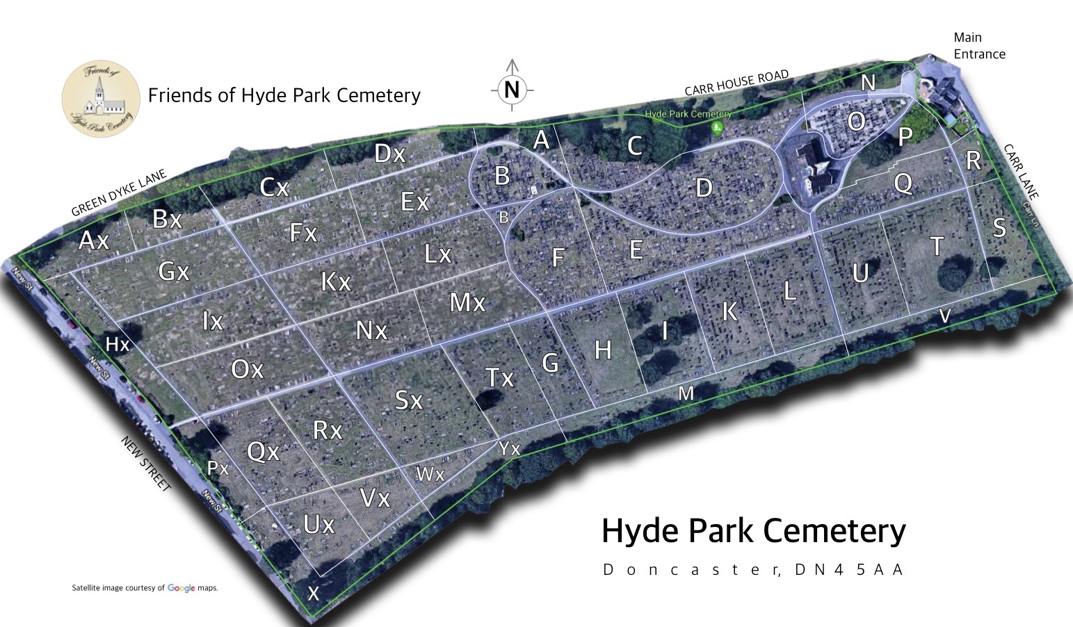
 Cemetery Plan showing the 45 sections and key locations.
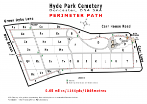 Perimeter Path distance as measured with a tape measure, a FitBit and a Garmin GPS device!!
Perimeter path distance measured as 0.65 miles, or slightly over 1 kilometer or 1144 yards.
Walk round the perimeter path 5196 times and you would have walked the equivalent distance from Doncaster to New York!!
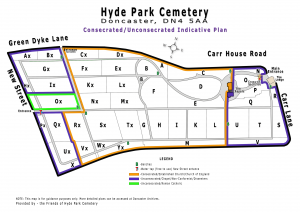 Cemetery Plan indicating the sections which are Consecrated ground and the sections which are Unconsecrated ground.